Original site: www.cdc.gov/pcd/issues/2008/jul/07_0159a.htm | RestoredCDC.org is an independent project, not affiliated with CDC or any federal entity. Visit CDC.gov for free official information. Due to archival on January 6, 2025, recent outbreak data is unavailable. Videos are not restored. Access data.restoredcdc.org for restored data. Use of this site implies acceptance of this disclaimer.

[More]
About Us Report Bug Compare Content

TOOLS AND TECHNIQUES
Use of BRFSS Data and GIS Technology for Rapid Public Health Response During Natural Disasters
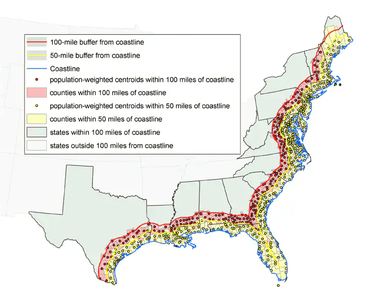
Map

Figure 1. Counties with population-weighted centroids within 50- and 100-mile radius of Gulf of Mexico and Atlantic Ocean coastlines, 2000. Data from U.S. Census Bureau (12).


Preventing Chronic Disease logo
Volume 5: No. 3, July 2008

CDC logo